 국립중앙도서관 "우편 복사 서비스"로 연결 됩니다.


 KCI
KCI DBpia
DBpiaThis study developed virtual geographic field trip learning content based on drone mapping technology within a metaverse space and applied it to elementary social studies education to analyze its educational effectiveness. The purpose of this study wa...
다국어 입력
あ
ぁ
か
が
さ
ざ
た
だ
な
は
ば
ぱ
ま
や
ゃ
ら
わ
ゎ
ん
い
ぃ
き
ぎ
し
じ
ち
ぢ
に
ひ
び
ぴ
み
り
う
ぅ
く
ぐ
す
ず
つ
づ
っ
ぬ
ふ
ぶ
ぷ
む
ゆ
ゅ
る
え
ぇ
け
げ
せ
ぜ
て
で
ね
へ
べ
ぺ
め
れ
お
ぉ
こ
ご
そ
ぞ
と
ど
の
ほ
ぼ
ぽ
も
よ
ょ
ろ
を
ア
ァ
カ
サ
ザ
タ
ダ
ナ
ハ
バ
パ
マ
ヤ
ャ
ラ
ワ
ヮ
ン
イ
ィ
キ
ギ
シ
ジ
チ
ヂ
ニ
ヒ
ビ
ピ
ミ
リ
ウ
ゥ
ク
グ
ス
ズ
ツ
ヅ
ッ
ヌ
フ
ブ
プ
ム
ユ
ュ
ル
エ
ェ
ケ
ゲ
セ
ゼ
テ
デ
ヘ
ベ
ペ
メ
レ
オ
ォ
コ
ゴ
ソ
ゾ
ト
ド
ノ
ホ
ボ
ポ
モ
ヨ
ョ
ロ
ヲ
―
http://chineseinput.net/에서 pinyin(병음)방식으로 중국어를 변환할 수 있습니다.
변환된 중국어를 복사하여 사용하시면 됩니다.
예시)
- 中文 을 입력하시려면 zhongwen을 입력하시고 space를누르시면됩니다.
- 北京 을 입력하시려면 beijing을 입력하시고 space를 누르시면 됩니다.
А
Б
В
Г
Д
Е
Ё
Ж
З
И
Й
К
Л
М
Н
О
П
Р
С
Т
У
Ф
Х
Ц
Ч
Ш
Щ
Ъ
Ы
Ь
Э
Ю
Я
а
б
в
г
д
е
ё
ж
з
и
й
к
л
м
н
о
п
р
с
т
у
ф
х
ц
ч
ш
щ
ъ
ы
ь
э
ю
я
′
″
℃
Å
¢
£
¥
¤
℉
‰
$
%
F
₩
㎕
㎖
㎗
ℓ
㎘
㏄
㎣
㎤
㎥
㎦
㎙
㎚
㎛
㎜
㎝
㎞
㎟
㎠
㎡
㎢
㏊
㎍
㎎
㎏
㏏
㎈
㎉
㏈
㎧
㎨
㎰
㎱
㎲
㎳
㎴
㎵
㎶
㎷
㎸
㎹
㎀
㎁
㎂
㎃
㎄
㎺
㎻
㎽
㎾
㎿
㎐
㎑
㎒
㎓
㎔
Ω
㏀
㏁
㎊
㎋
㎌
㏖
㏅
㎭
㎮
㎯
㏛
㎩
㎪
㎫
㎬
㏝
㏐
㏓
㏃
㏉
㏜
㏆

RISS 인기검색어
https://www.riss.kr/link?id=A109532241
- 저자
- 발행기관
- 학술지명
- 권호사항
-
발행연도
2024
-
작성언어
Korean
- 주제어
-
KDC
374
-
등재정보
KCI등재
-
자료형태
학술저널
- 발행기관 URL
-
수록면
25-43(19쪽)
- DOI식별코드
- 제공처
-
0
상세조회 -
0
다운로드
부가정보
다국어 초록 (Multilingual Abstract)
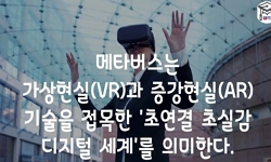
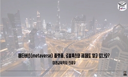
This study developed virtual geographic field trip learning content based on drone mapping technology within a metaverse space and applied it to elementary social studies education to analyze its educational effectiveness. The purpose of this study was to design a metaverse environment using data collected through drone mapping, allowing learners to engage in self-directed exploration and learning. The study focused on the 6th-grade social studies curriculum, specifically the theme of “Environmental Protection and Sustainable Development.” Key factors such as academic achievement, spatial thinking, problem-solving ability, interactivity, and learning satisfaction were measured. The results showed that learning with drone mapping-based metaverse environments positively impacted students' academic achievement and spatial thinking. Notably, middle-achieving students demonstrated significant improvement, and the study highlighted the importance of self-directed learning experiences. Collaborative interactions in the metaverse space also enhanced student motivation and problem-solving skills, leading to high engagement and learning satisfaction. This study suggests that integrating drone mapping with metaverse technology has the potential to foster creative thinking and real-world problem-solving skills in learners.
This study developed virtual geographic field trip learning content based on drone mapping technology within a metaverse space and applied it to elementary social studies education to analyze its educational effectiveness. The purpose of this study was to design a metaverse environment using data collected through drone mapping, allowing learners to engage in self-directed exploration and learning. The study focused on the 6th-grade social studies curriculum, specifically the theme of “Environmental Protection and Sustainable Development.” Key factors such as academic achievement, spatial thinking, problem-solving ability, interactivity, and learning satisfaction were measured. The results showed that learning with drone mapping-based metaverse environments positively impacted students' academic achievement and spatial thinking. Notably, middle-achieving students demonstrated significant improvement, and the study highlighted the importance of self-directed learning experiences. Collaborative interactions in the metaverse space also enhanced student motivation and problem-solving skills, leading to high engagement and learning satisfaction. This study suggests that integrating drone mapping with metaverse technology has the potential to foster creative thinking and real-world problem-solving skills in learners.
동일학술지(권/호) 다른 논문
-
AI편향 시대에 ‘유연한 편향성’ 함양을 위한 사회과 수업 실천
- 한국사회과교육연구학회
- 박기범(Park, Keeburm)
- 2024
- KCI등재
-
2022 개정 교육과정의 교과별 미디어 리터러시 교육 내용 분석 및 사회과 미디어 리터러시 교육의 방향
- 한국사회과교육연구학회
- 송미리(Song, Miri)
- 2024
- KCI등재
-
문화경관(Culture landscape)으로서 광주천 다리의 의미 탐색
- 한국사회과교육연구학회
- 송하인(Song, Ha In)
- 2024
- KCI등재
-
MYP 개인과 사회 관련 개념과 2022 개정 사회과 교육과정 간 연계성 분석: 중학 사회-2 과정을 중심으로
- 한국사회과교육연구학회
- 김진영(Kim, Jin-Young)
- 2024
- KCI등재
분석정보


이 자료와 함께 이용한 RISS 자료
나만을 위한 추천자료


