 국립중앙도서관 "우편 복사 서비스"로 연결 됩니다.


 ScienceON
 KISS
KISS
Today, many smart sensor’s measurement instruments are used to check the safety situation of various medium and large bridge structures that should be maintained in the construction facilities, but most of them use the method of measuring and confir...
다국어 입력
あ
ぁ
か
が
さ
ざ
た
だ
な
は
ば
ぱ
ま
や
ゃ
ら
わ
ゎ
ん
い
ぃ
き
ぎ
し
じ
ち
ぢ
に
ひ
び
ぴ
み
り
う
ぅ
く
ぐ
す
ず
つ
づ
っ
ぬ
ふ
ぶ
ぷ
む
ゆ
ゅ
る
え
ぇ
け
げ
せ
ぜ
て
で
ね
へ
べ
ぺ
め
れ
お
ぉ
こ
ご
そ
ぞ
と
ど
の
ほ
ぼ
ぽ
も
よ
ょ
ろ
を
ア
ァ
カ
サ
ザ
タ
ダ
ナ
ハ
バ
パ
マ
ヤ
ャ
ラ
ワ
ヮ
ン
イ
ィ
キ
ギ
シ
ジ
チ
ヂ
ニ
ヒ
ビ
ピ
ミ
リ
ウ
ゥ
ク
グ
ス
ズ
ツ
ヅ
ッ
ヌ
フ
ブ
プ
ム
ユ
ュ
ル
エ
ェ
ケ
ゲ
セ
ゼ
テ
デ
ヘ
ベ
ペ
メ
レ
オ
ォ
コ
ゴ
ソ
ゾ
ト
ド
ノ
ホ
ボ
ポ
モ
ヨ
ョ
ロ
ヲ
―
http://chineseinput.net/에서 pinyin(병음)방식으로 중국어를 변환할 수 있습니다.
변환된 중국어를 복사하여 사용하시면 됩니다.
예시)
- 中文 을 입력하시려면 zhongwen을 입력하시고 space를누르시면됩니다.
- 北京 을 입력하시려면 beijing을 입력하시고 space를 누르시면 됩니다.
А
Б
В
Г
Д
Е
Ё
Ж
З
И
Й
К
Л
М
Н
О
П
Р
С
Т
У
Ф
Х
Ц
Ч
Ш
Щ
Ъ
Ы
Ь
Э
Ю
Я
а
б
в
г
д
е
ё
ж
з
и
й
к
л
м
н
о
п
р
с
т
у
ф
х
ц
ч
ш
щ
ъ
ы
ь
э
ю
я
′
″
℃
Å
¢
£
¥
¤
℉
‰
$
%
F
₩
㎕
㎖
㎗
ℓ
㎘
㏄
㎣
㎤
㎥
㎦
㎙
㎚
㎛
㎜
㎝
㎞
㎟
㎠
㎡
㎢
㏊
㎍
㎎
㎏
㏏
㎈
㎉
㏈
㎧
㎨
㎰
㎱
㎲
㎳
㎴
㎵
㎶
㎷
㎸
㎹
㎀
㎁
㎂
㎃
㎄
㎺
㎻
㎽
㎾
㎿
㎐
㎑
㎒
㎓
㎔
Ω
㏀
㏁
㎊
㎋
㎌
㏖
㏅
㎭
㎮
㎯
㏛
㎩
㎪
㎫
㎬
㏝
㏐
㏓
㏃
㏉
㏜
㏆

RISS 인기검색어

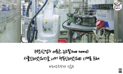
스마트 센서 기반의 교량 시설물 안전 모니터링 기법 연구 = A Study on the Safety Monitoring of Bridge Facilities based on Smart Sensors
한글로보기https://www.riss.kr/link?id=A106268937
- 저자
- 발행기관
- 학술지명
- 권호사항
-
발행연도
2019
-
작성언어
-
-
주제어
교량 ; GPS/GNSS ; 환경센서 ; USN ; 사물인터넷 ; Old Bridge ; Environment Sensor ; IoT
-
KDC
500
-
등재정보
KCI등재
-
자료형태
학술저널
- 발행기관 URL
-
수록면
97-106(10쪽)
-
KCI 피인용횟수
0
- DOI식별코드
- 제공처
- 소장기관
-
0
상세조회 -
0
다운로드
부가정보
다국어 초록 (Multilingual Abstract)
Today, many smart sensor’s measurement instruments are used to check the safety situation of various medium and large bridge structures that should be maintained in the construction facilities, but most of them use the method of measuring and confirming the displacement behavior of the bridge at regular intervals. In order to continuously check the safety situation, various measuring instruments are used, but most of them are not able to measure and measure the displacement and behavior of main construction structures at regular intervals. In this study, GNSS and environment smart sensors and drone’s image data are transmitted to wireless network so that risk of many bridge’s structures can be detected beforehand. As a result, by diagnosing the fine displacement of the bridge in real time and its condition, reinforcement, repair and disaster prevention measures for the structural parts of the bridges, which are expected to be dangerous, and various disasters and accidents can be prevented, and disaster can be prevented could suggest a new alternative.
참고문헌 (Reference)
1 연상호, "유비쿼터스 기반 건설현장 관리시스템의 구현" 한국인터넷방송통신학회 13 (13): 239-243, 2013
2 Hanbaec Electronics Research Lab, "u-sensor network system using ZigbeX" 2015
3 연상호, "u-city를 위한 3차원 공간 영상 도시 모델 생성 및 적용 방안" 한국인터넷방송통신학회 8 (8): 47-52, 2008
4 Arches, "a Framework for Modeling Complex Terrains" 28 (28): 457-467, 2009
5 Hanbaek, "Ubiquitous Sensor Network System Using Zigbe X" Hanbaek Electronix Tecnology Institute 2013
6 오선진, "USN을 위한 결함허용 라우팅 프로토콜의 설계" 한국인터넷방송통신학회 9 (9): 51-57, 2009
7 IEEE, "The Influence of Terrain Scattering on Radio Links in Hilly Mountainous Regions" 61 (61): 1385-1395, 2013
8 IEEE, "Terrain Modeling from Lidar Range Data in Natural landscapes: A Predictive and Bayesian Framework. Large-Scale Physics-Based Terrain Editing Using Adaptive Tiles on the GPU" 48 (48): 568-578, 2010
9 S. Yeon, "Technique on the 3-D Terrain Analysis Modeling for Optimum Site Selection and development of Stereo Tourism in the Future" 2013
10 C.Shen, "Sensor Information Networking Architecture and Applications" 8 (8): 52-59, 2001
11 Arora, R, "Road networking using remote sensing and GIS technologies" 3 (3): 1522-1525, 2005
12 IEEE, "Merging GPS and Atmospherically Corrected InSAR Data to Map 3-D Terrain Displacement Velocity" 9 (9): 2354-2360, 2011
13 J. Hightower, "Location Systems for Ubiquitous Computing" 34 (34): 57-66, 2001
14 연상호, "GNSS 기반의 정밀측위 및 미세변위 모니터링 개발" 한국인터넷방송통신학회 17 (17): 145-152, 2017
15 S.Yeon, "GIS/GNSS and USN/IoT Application for Construction Deformation Prevention" 29-, 2018
16 Boulis, C. Han, "Design and Implementation of a Framework for Programmable and Efficient Sensor Networks" 2003
17 S.H. Yeon, "Construction Disaster Prevention by use of Spatial Image and GNSS and IoT" 14 (14): 2016
18 Paul. Mather, "Computer Processing of Remotely-Sensed Image" John Wiley Sons 189-202, 1987
19 IEEE, "Compression of Large-Scale Terrain Data for Real-Time Visualization Using a Tiled Quad Tree" 4 (4): 741-759, 2004
20 F. Rottensteiner, "Automatic Generation of Building Models from LiDAR data and the Integration of aerial images" XXXIV : 2003
21 E. Steinle, "Assessment of Laser Scanning Technology for Change Detection in Buildings" University of Karlsruhe Institute for Photogrammetry and Remote Sensing 2015
22 S.Yeon, "Application technology of 3D spatial information by integration of aerial photo and laser data" 6 (6): 193-197, 2008
동일학술지(권/호) 다른 논문
-
UAV를 활용한 농촌지역 비점오염원 야적퇴비 관리상태 및 적재량 변화 모니터링
- 한국지리정보학회
- 박건웅 ( Geon-ung Park )
- 2019
- KCI등재
-
- 한국지리정보학회
- 정충호 ( Jung-choong Ho )
- 2019
- KCI등재
-
폐금속 광산의 토양 중금속 오염 조사 자료 해석을 위한 핫스팟 분석의 적용
- 한국지리정보학회
- 이채영 ( Chae-young Lee )
- 2019
- KCI등재
-
시계열 고해상도 항공영상을 이용한 소나무재선충병 감염목 탐지 - 강원대학교 학술림 일원을 대상으로 -
- 한국지리정보학회
- 박정묵 ( Jeong-mook Park )
- 2019
- KCI등재
분석정보
인용정보 인용지수 설명보기
학술지 이력
| 연월일 | 이력구분 | 이력상세 | 등재구분 |
|---|---|---|---|
| 2026 | 평가예정 | 재인증평가 신청대상 (재인증) | |
| 2020-01-01 | 평가 | 등재학술지 유지 (재인증) | |
| 2017-01-01 | 평가 | 등재학술지 유지 (계속평가) | |
| 2013-01-01 | 평가 | 등재학술지 유지 (등재유지) | |
| 2010-01-01 | 평가 | 등재학술지 유지 (등재유지) | |
| 2008-01-01 | 평가 | 등재학술지 유지 (등재유지) | |
| 2005-01-01 | 평가 | 등재학술지 선정 (등재후보2차) | |
| 2004-01-01 | 평가 | 등재후보 1차 PASS (등재후보1차) |  |
| 2002-01-01 | 평가 | 등재후보학술지 선정 (신규평가) | |
학술지 인용정보
| 기준연도 | WOS-KCI 통합IF(2년) | KCIF(2년) | KCIF(3년) |
|---|---|---|---|
| 2016 | 0.82 | 0.82 | 0.84 |
| KCIF(4년) | KCIF(5년) | 중심성지수(3년) | 즉시성지수 |
| 0.88 | 0.8 | 0.98 | 0.14 |


이 자료와 함께 이용한 RISS 자료
나만을 위한 추천자료


