 국립중앙도서관 "우편 복사 서비스"로 연결 됩니다.

 KISS
KISS(연구배경 및 목적) 도시 스카이라인은 도시의 상징적 이미지로서 시각적 즐거움을 제공하고, 건축물의 배치와 연결을 통해 경관의 일관성을 유지하는 중요한 요소이다. 그러나 한국은 급격...
다국어 입력
あ
ぁ
か
が
さ
ざ
た
だ
な
は
ば
ぱ
ま
や
ゃ
ら
わ
ゎ
ん
い
ぃ
き
ぎ
し
じ
ち
ぢ
に
ひ
び
ぴ
み
り
う
ぅ
く
ぐ
す
ず
つ
づ
っ
ぬ
ふ
ぶ
ぷ
む
ゆ
ゅ
る
え
ぇ
け
げ
せ
ぜ
て
で
ね
へ
べ
ぺ
め
れ
お
ぉ
こ
ご
そ
ぞ
と
ど
の
ほ
ぼ
ぽ
も
よ
ょ
ろ
を
ア
ァ
カ
サ
ザ
タ
ダ
ナ
ハ
バ
パ
マ
ヤ
ャ
ラ
ワ
ヮ
ン
イ
ィ
キ
ギ
シ
ジ
チ
ヂ
ニ
ヒ
ビ
ピ
ミ
リ
ウ
ゥ
ク
グ
ス
ズ
ツ
ヅ
ッ
ヌ
フ
ブ
プ
ム
ユ
ュ
ル
エ
ェ
ケ
ゲ
セ
ゼ
テ
デ
ヘ
ベ
ペ
メ
レ
オ
ォ
コ
ゴ
ソ
ゾ
ト
ド
ノ
ホ
ボ
ポ
モ
ヨ
ョ
ロ
ヲ
―
http://chineseinput.net/에서 pinyin(병음)방식으로 중국어를 변환할 수 있습니다.
변환된 중국어를 복사하여 사용하시면 됩니다.
예시)
- 中文 을 입력하시려면 zhongwen을 입력하시고 space를누르시면됩니다.
- 北京 을 입력하시려면 beijing을 입력하시고 space를 누르시면 됩니다.
А
Б
В
Г
Д
Е
Ё
Ж
З
И
Й
К
Л
М
Н
О
П
Р
С
Т
У
Ф
Х
Ц
Ч
Ш
Щ
Ъ
Ы
Ь
Э
Ю
Я
а
б
в
г
д
е
ё
ж
з
и
й
к
л
м
н
о
п
р
с
т
у
ф
х
ц
ч
ш
щ
ъ
ы
ь
э
ю
я
′
″
℃
Å
¢
£
¥
¤
℉
‰
$
%
F
₩
㎕
㎖
㎗
ℓ
㎘
㏄
㎣
㎤
㎥
㎦
㎙
㎚
㎛
㎜
㎝
㎞
㎟
㎠
㎡
㎢
㏊
㎍
㎎
㎏
㏏
㎈
㎉
㏈
㎧
㎨
㎰
㎱
㎲
㎳
㎴
㎵
㎶
㎷
㎸
㎹
㎀
㎁
㎂
㎃
㎄
㎺
㎻
㎽
㎾
㎿
㎐
㎑
㎒
㎓
㎔
Ω
㏀
㏁
㎊
㎋
㎌
㏖
㏅
㎭
㎮
㎯
㏛
㎩
㎪
㎫
㎬
㏝
㏐
㏓
㏃
㏉
㏜
㏆

RISS 인기검색어

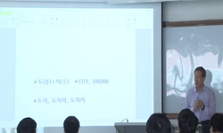
형태기반코드를 통한 한국 도시 사례분석에 관한 연구 -테헤란로 일대 스카이라인을 중심으로- = A Study of Korean Urban Case Analysis through Form-based Codes -Focused on the skyline of Samseong dong-
한글로보기https://www.riss.kr/link?id=A109487961
- 저자
- 발행기관
- 학술지명
- 권호사항
-
발행연도
2024
-
작성언어
Korean
- 주제어
-
등재정보
KCI등재
-
자료형태
학술저널
- 발행기관 URL
-
수록면
283-298(16쪽)
- 제공처
-
0
상세조회 -
0
다운로드
부가정보
국문 초록 (Abstract)
(연구배경 및 목적) 도시 스카이라인은 도시의 상징적 이미지로서 시각적 즐거움을 제공하고, 건축물의 배치와 연결을 통해 경관의 일관성을 유지하는 중요한 요소이다. 그러나 한국은 급격한 경제 성장과 도시화로 인해 부동산 시장 논리에 따라 도시 경관이 훼손되고, 고밀도 개발로 인해 스카이라인 관리 문제가 발생하고 있다. 따라서 강남구 테헤란로 일대의 도시 공간 특성을 파악하고, 고층 건축물의 주거화와 사유화, 산발적 도시계획 등으로 인한 문제점을 식별하며, 테헤란로의 스카이라인을 지속 가능하고 조화롭게 발전시키기 위한 전략적 접근을 제시하고자 한다. (연구방법) 본 연구는 서울 강남구 테헤란로 일대의 도시 스카이라인의 특성을 파악하고 체계적인 경관 관리 방안을 모색하기 위해 형태 기반 코드를 활용하여 분석한다. 테헤란로 일대는 1970년대 국가사업으로 개발되기 시작하면서 현대적인 도시 모습과 저층 고밀도 건물이 공존하는 지역이다. 따라서 이 지역의 도시 공간 특성을 파악하고 형태 기반 코드를 통해 스카이라인에 영향을 미치는 계획 요소를 추출하여 테헤란로 스카이라인의 특징을 파악할 수 있도록 한다. (결과) 강남구 테헤란로는 경제적 활동이 활발한 지역으로 많은 고층 건물과 기업 빌딩이 밀집해 있다. 그러나 지형의 고저차와 관련한 건물 높이 제한이 없어 불균형한 스카이라인이 형성되고, 이는 도시의 시각적 일관성을 해치고 보행 환경에 부정적인 영향을 미친다. 주요 사거리 중심으로 기능적 건물이 밀집해 있고, 각 블록마다 건물 밀도가 높으며 시각적으로도 압도적인 분위기가 조성되고 있다. 강남역 인근은 높은 건물 밀도와 복잡한 교통체증으로 혼잡해 보행자 중심의 도시 계획이 요구된다. 기존 조닝 제도와 건축물 높이 규제만으로는 충분하지 않으며, 테헤란로의 스카이라인 문제를 해결하기 위해 형태 기반 코드와 같은 종합적인 접근이 필요하다. (결론) 테헤란로의 스카이라인은 법적 규제의 영향을 받으며, 지역별로 고저차와 건물 높이 제한이 없어 불균형한 모습을 보인다. 이러한 스카이라인은 도시의 시각적 일관성과 보행 환경에 부정적인 영향을 미치고 있으며, 특히 강남역 인근은 높은 건물 밀도와 교통체증으로 인해 혼잡하다. 이를 해결하기 위해서는 기존 조닝 제도만으로는 충분하지 않으며, 형태 기반 코드와 같은 종합적인 도시 계획 도구가 필요하다. 이는 도시 형태와 건축 양식을 고려한 유연한 디자인을 가능하게 하여, 대상지의 스카이라인을 안정화하고 시각적 조화를 이끌어낼 수 있다. 초기 단계부터 이러한 규제를 통해 경관 관리가 이루어지면, 시각적으로 조화로운 도시 환경을 형성할 수 있다.
(연구배경 및 목적) 도시 스카이라인은 도시의 상징적 이미지로서 시각적 즐거움을 제공하고, 건축물의 배치와 연결을 통해 경관의 일관성을 유지하는 중요한 요소이다. 그러나 한국은 급격한 경제 성장과 도시화로 인해 부동산 시장 논리에 따라 도시 경관이 훼손되고, 고밀도 개발로 인해 스카이라인 관리 문제가 발생하고 있다. 따라서 강남구 테헤란로 일대의 도시 공간 특성을 파악하고, 고층 건축물의 주거화와 사유화, 산발적 도시계획 등으로 인한 문제점을 식별하며, 테헤란로의 스카이라인을 지속 가능하고 조화롭게 발전시키기 위한 전략적 접근을 제시하고자 한다. (연구방법) 본 연구는 서울 강남구 테헤란로 일대의 도시 스카이라인의 특성을 파악하고 체계적인 경관 관리 방안을 모색하기 위해 형태 기반 코드를 활용하여 분석한다. 테헤란로 일대는 1970년대 국가사업으로 개발되기 시작하면서 현대적인 도시 모습과 저층 고밀도 건물이 공존하는 지역이다. 따라서 이 지역의 도시 공간 특성을 파악하고 형태 기반 코드를 통해 스카이라인에 영향을 미치는 계획 요소를 추출하여 테헤란로 스카이라인의 특징을 파악할 수 있도록 한다. (결과) 강남구 테헤란로는 경제적 활동이 활발한 지역으로 많은 고층 건물과 기업 빌딩이 밀집해 있다. 그러나 지형의 고저차와 관련한 건물 높이 제한이 없어 불균형한 스카이라인이 형성되고, 이는 도시의 시각적 일관성을 해치고 보행 환경에 부정적인 영향을 미친다. 주요 사거리 중심으로 기능적 건물이 밀집해 있고, 각 블록마다 건물 밀도가 높으며 시각적으로도 압도적인 분위기가 조성되고 있다. 강남역 인근은 높은 건물 밀도와 복잡한 교통체증으로 혼잡해 보행자 중심의 도시 계획이 요구된다. 기존 조닝 제도와 건축물 높이 규제만으로는 충분하지 않으며, 테헤란로의 스카이라인 문제를 해결하기 위해 형태 기반 코드와 같은 종합적인 접근이 필요하다. (결론) 테헤란로의 스카이라인은 법적 규제의 영향을 받으며, 지역별로 고저차와 건물 높이 제한이 없어 불균형한 모습을 보인다. 이러한 스카이라인은 도시의 시각적 일관성과 보행 환경에 부정적인 영향을 미치고 있으며, 특히 강남역 인근은 높은 건물 밀도와 교통체증으로 인해 혼잡하다. 이를 해결하기 위해서는 기존 조닝 제도만으로는 충분하지 않으며, 형태 기반 코드와 같은 종합적인 도시 계획 도구가 필요하다. 이는 도시 형태와 건축 양식을 고려한 유연한 디자인을 가능하게 하여, 대상지의 스카이라인을 안정화하고 시각적 조화를 이끌어낼 수 있다. 초기 단계부터 이러한 규제를 통해 경관 관리가 이루어지면, 시각적으로 조화로운 도시 환경을 형성할 수 있다.
다국어 초록 (Multilingual Abstract)
(Background and Purpose) The urban skyline is the iconic image of a city, providing visual pleasure and maintaining the coherence of the landscape through the arrangement and connection of buildings. However, due to rapid economic growth and urbanization in Korea, urban landscapes are being damaged by the logic of the real estate market, and skyline management problems are occurring due to high-density development. Therefore, this study identifies the urban space characteristics of Teheran-ro in Gangnam-gu, Seoul, identifies the problems caused by residentialization and privatization of high-rise buildings and sporadic urban planning, and proposes a strategic approach to develop the skyline of Teheran-ro sustainably and harmoniously. (Method) This study analyzes the urban skyline of Teheran-ro area in Gangnam-gu, Seoul, using morphology-based codes to identify the characteristics of the urban skyline and explore systematic landscape management. The Teheran-ro area was developed as a national project in the 1970s and is an area where modern cityscape and low-rise high-density buildings coexist. Therefore, we identify the urban space characteristics of the area and extract the planning elements that affect the skyline through shape-based codes to identify the characteristics of the Tehran Road skyline. (Results) Gangnam-gu Teheran-ro is an economically active neighborhood with many skyscrapers and corporate buildings. However, the lack of building height restrictions related to the elevation difference of the terrain creates an unbalanced skyline, which undermines the visual coherence of the city and negatively impacts the pedestrian environment. Functional buildings are clustered around major intersections, and each block has a high building density, creating a visually overwhelming atmosphere. The area around Gangnam Station is congested with high building density and complex traffic, requiring pedestrian-oriented urban planning. The existing zoning system and building height regulations are not enough, and a comprehensive approach such as a form-based code is needed to address Tehran's skyline issues. (Conclusions) Tehran's skyline is influenced by legal regulations and is unbalanced due to the lack of elevation differences and building height restrictions in different neighborhoods. This skyline has a negative impact on the visual coherence and pedestrian environment of the city, especially near Gangnam Station, which is congested due to high building density and traffic. To address this, the existing zoning system is not enough, and a comprehensive urban planning tool such as a form-based code is needed. This allows for flexible design that takes into account urban form and architectural styles, stabilizing the destination's skyline and creating visual harmony. When landscape management is addressed through these regulations from the outset, a visually harmonious urban environment can be created.
(Background and Purpose) The urban skyline is the iconic image of a city, providing visual pleasure and maintaining the coherence of the landscape through the arrangement and connection of buildings. However, due to rapid economic growth and urbanizat...
(Background and Purpose) The urban skyline is the iconic image of a city, providing visual pleasure and maintaining the coherence of the landscape through the arrangement and connection of buildings. However, due to rapid economic growth and urbanization in Korea, urban landscapes are being damaged by the logic of the real estate market, and skyline management problems are occurring due to high-density development. Therefore, this study identifies the urban space characteristics of Teheran-ro in Gangnam-gu, Seoul, identifies the problems caused by residentialization and privatization of high-rise buildings and sporadic urban planning, and proposes a strategic approach to develop the skyline of Teheran-ro sustainably and harmoniously. (Method) This study analyzes the urban skyline of Teheran-ro area in Gangnam-gu, Seoul, using morphology-based codes to identify the characteristics of the urban skyline and explore systematic landscape management. The Teheran-ro area was developed as a national project in the 1970s and is an area where modern cityscape and low-rise high-density buildings coexist. Therefore, we identify the urban space characteristics of the area and extract the planning elements that affect the skyline through shape-based codes to identify the characteristics of the Tehran Road skyline. (Results) Gangnam-gu Teheran-ro is an economically active neighborhood with many skyscrapers and corporate buildings. However, the lack of building height restrictions related to the elevation difference of the terrain creates an unbalanced skyline, which undermines the visual coherence of the city and negatively impacts the pedestrian environment. Functional buildings are clustered around major intersections, and each block has a high building density, creating a visually overwhelming atmosphere. The area around Gangnam Station is congested with high building density and complex traffic, requiring pedestrian-oriented urban planning. The existing zoning system and building height regulations are not enough, and a comprehensive approach such as a form-based code is needed to address Tehran's skyline issues. (Conclusions) Tehran's skyline is influenced by legal regulations and is unbalanced due to the lack of elevation differences and building height restrictions in different neighborhoods. This skyline has a negative impact on the visual coherence and pedestrian environment of the city, especially near Gangnam Station, which is congested due to high building density and traffic. To address this, the existing zoning system is not enough, and a comprehensive urban planning tool such as a form-based code is needed. This allows for flexible design that takes into account urban form and architectural styles, stabilizing the destination's skyline and creating visual harmony. When landscape management is addressed through these regulations from the outset, a visually harmonious urban environment can be created.
동일학술지(권/호) 다른 논문
-
- 한국공간디자인학회
- 임예슬
- 2024
- KCI등재
-
프랙털(Fractal) 특성을 적용한 형상 문법 생성 연구 - 프랙털 기하학 특성이 적용된 형상 문법 건축 조형의 미의식 중심으로 -
- 한국공간디자인학회
- 김가영
- 2024
- KCI등재
-
- 한국공간디자인학회
- 전수아
- 2024
- KCI등재
-
예비 노년층(Pre-Seniors)의‘삶의 마지막 공간’인식에 관한 주관성 연구 - Q 방법론을 중심으로 -
- 한국공간디자인학회
- 박변갑
- 2024
- KCI등재
분석정보
이 자료와 함께 이용한 RISS 자료
나만을 위한 추천자료


