 국립중앙도서관 "우편 복사 서비스"로 연결 됩니다.

 ScienceON
 DBpia
DBpia
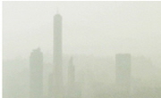
도시화에 따른 이산화탄소의 발생이 증대되고 있는 실정에서 이를 해결할 수 있는 대안으로 도시의 녹지화가 추진되고 있다. 도시지역에서 수목은 이산화탄소를 저감시킬 뿐만 아니라 심미...
다국어 입력
あ
ぁ
か
が
さ
ざ
た
だ
な
は
ば
ぱ
ま
や
ゃ
ら
わ
ゎ
ん
い
ぃ
き
ぎ
し
じ
ち
ぢ
に
ひ
び
ぴ
み
り
う
ぅ
く
ぐ
す
ず
つ
づ
っ
ぬ
ふ
ぶ
ぷ
む
ゆ
ゅ
る
え
ぇ
け
げ
せ
ぜ
て
で
ね
へ
べ
ぺ
め
れ
お
ぉ
こ
ご
そ
ぞ
と
ど
の
ほ
ぼ
ぽ
も
よ
ょ
ろ
を
ア
ァ
カ
サ
ザ
タ
ダ
ナ
ハ
バ
パ
マ
ヤ
ャ
ラ
ワ
ヮ
ン
イ
ィ
キ
ギ
シ
ジ
チ
ヂ
ニ
ヒ
ビ
ピ
ミ
リ
ウ
ゥ
ク
グ
ス
ズ
ツ
ヅ
ッ
ヌ
フ
ブ
プ
ム
ユ
ュ
ル
エ
ェ
ケ
ゲ
セ
ゼ
テ
デ
ヘ
ベ
ペ
メ
レ
オ
ォ
コ
ゴ
ソ
ゾ
ト
ド
ノ
ホ
ボ
ポ
モ
ヨ
ョ
ロ
ヲ
―
http://chineseinput.net/에서 pinyin(병음)방식으로 중국어를 변환할 수 있습니다.
변환된 중국어를 복사하여 사용하시면 됩니다.
예시)
- 中文 을 입력하시려면 zhongwen을 입력하시고 space를누르시면됩니다.
- 北京 을 입력하시려면 beijing을 입력하시고 space를 누르시면 됩니다.
А
Б
В
Г
Д
Е
Ё
Ж
З
И
Й
К
Л
М
Н
О
П
Р
С
Т
У
Ф
Х
Ц
Ч
Ш
Щ
Ъ
Ы
Ь
Э
Ю
Я
а
б
в
г
д
е
ё
ж
з
и
й
к
л
м
н
о
п
р
с
т
у
ф
х
ц
ч
ш
щ
ъ
ы
ь
э
ю
я
′
″
℃
Å
¢
£
¥
¤
℉
‰
$
%
F
₩
㎕
㎖
㎗
ℓ
㎘
㏄
㎣
㎤
㎥
㎦
㎙
㎚
㎛
㎜
㎝
㎞
㎟
㎠
㎡
㎢
㏊
㎍
㎎
㎏
㏏
㎈
㎉
㏈
㎧
㎨
㎰
㎱
㎲
㎳
㎴
㎵
㎶
㎷
㎸
㎹
㎀
㎁
㎂
㎃
㎄
㎺
㎻
㎽
㎾
㎿
㎐
㎑
㎒
㎓
㎔
Ω
㏀
㏁
㎊
㎋
㎌
㏖
㏅
㎭
㎮
㎯
㏛
㎩
㎪
㎫
㎬
㏝
㏐
㏓
㏃
㏉
㏜
㏆

RISS 인기검색어
https://www.riss.kr/link?id=A82502204
- 저자
- 발행기관
- 학술지명
- 권호사항
-
발행연도
2010
-
작성언어
Korean
- 주제어
-
등재정보
KCI등재
-
자료형태
학술저널
- 발행기관 URL
-
수록면
11-20(10쪽)
-
KCI 피인용횟수
7
- 제공처
- 소장기관
-
0
상세조회 -
0
다운로드
부가정보
국문 초록 (Abstract)
도시화에 따른 이산화탄소의 발생이 증대되고 있는 실정에서 이를 해결할 수 있는 대안으로 도시의 녹지화가 추진되고 있다. 도시지역에서 수목은 이산화탄소를 저감시킬 뿐만 아니라 심미적인 효과가 있다. 본 연구에서는 이러한 수목의 공간정보를 효율적으로 추출하기 위하여 라이다 자료를 이용하는 방법론을 제안하였다. 제안한 방법론에서는 수목추출에 따른 작업의 효율성을 향상시키기 위하여 점, 면, 영상기반의 복합적 자료처리를 수행하였다. 기존의 정규화된 수치표면모델은 건물과 수목정보를 모두 포함하고 있어 수목 추출 시 자료처리의 복잡성이 높은 문제점을 안고 있다. 따라서 이러한 문제점을 개선하기 위하여 본 연구에서는 건물추정영역을 제거한 수치표면모델을 이용하였다. 제안한 방법론의 적용성을 평가하기 위하여 도시지역 내의 건물과 수목이 공존하는 3개의 지역을 선정하였으며 수목추출의 정확도는 디지털 카메라에 의해 촬영된 디지털 영상과 비교하였다.
다국어 초록 (Multilingual Abstract)
In situation that carbon dioxide emissions are being increased as urbanization, urban green space is being promoted as an alternative to find solution for these problems. In urban areas, trees have the ability to reduce carbon dioxide as well as to be...
In situation that carbon dioxide emissions are being increased as urbanization, urban green space is being promoted as an alternative to find solution for these problems. In urban areas, trees have the ability to reduce carbon dioxide as well as to be aesthetic effect. In this study, we proposed the methodology which uses only LIDAR data in order to extract these trees information effectively. To improve the operational efficiency according to the extraction of trees, the proposed methodology was carried out using multiple data processing such as point, polygon and raster. Because the existing NDSM(Normalized Digital Surface Model) contains both the building and tree information, it has the problems of high complexity of data processing for extracting trees. Therefore, in order to improve these problems, this study used modified NDSM which was removed estimate regions of building. To evaluate the performance of the proposed methodology, three different zones which coexist buildings and trees within urban areas were selected and the accuracy of extracted trees was compared with the image taken by digital camera.
목차 (Table of Contents)
- 要旨
- Abstract
- 1. 서론
- 2. 수목공간정보 추출 방법론
- 3. 실험
- 要旨
- Abstract
- 1. 서론
- 2. 수목공간정보 추출 방법론
- 3. 실험
- 4. 실험 결과 분석
- 5. 결론
- 감사의 글
- 참고문헌
참고문헌 (Reference)
1 김의명, "영상 및 점기반 자료처리에 의한 항공 라이다 자료의 건물경계추출" 한국지형공간정보학회 17 (17): 43-52, 2009
2 박은진, "도시 수목의 이산화탄소 흡수량 산정 및 흡수효과 증진 방안" 경기개발연구원 2009
3 Mei, C., "Tree Crown Delineation from Digital Elevation Models and High Resolution Imagery" 2010
4 Tiede, D., "Transferability of a Tree-Crown Delineation Approach Using Region-specific Segmentation" 1883-1890, 2007
5 Chen, L., "The Generation of 3D Tree Models by the Integration of Multi-Sensor Data" 34-43, 2006
6 Brattberg, O., "Terrain Classification Using Airborne Lidar Data and Aerial Imagery" XXXVII (XXXVII): 261-266, 2008
7 Kim, C., "Obejct-based Integration of Photogrammetric and LiDAR Data for Accurate Reconstruction and Visualization of Building Models" UCGE 2008
8 최연웅, "LiDAR자료의 지면정보 추출기법의 정확도 평가" 한국지형공간정보학회 14 (14): 19-26, 2006
9 Persson, Å., "Extraction of Individual Trees Using Laser Radar Data" Swdish Defence Research Agency 2001
10 Demir, N., "Extraction of Buildings and Trees Using Image and LiDAR Data" XXXVII (XXXVII): 313-318, 2008
11 Lim, C., "Estimation of Urban Tree Crown Volume based on Object-oriented Approach and LIDAR Data" ITC 2007
12 Axelsson, P., "DEM Generation from Laser Scanner Data Using Adaptive TIN Models" XXXIII (XXXIII): 85-92, 2000
13 Barilotti, A., "Curvature Analysis of LIDAR Data for Single Tree Species Classification in Alpine Latitude Forests" XXXVIII (XXXVIII): 129-134, 2009
14 Chang, Y., "Automatic Classification of LIDAR Data into Ground and Non-ground Points" XXXVII (XXXVII): 463-468, 2008
15 Wang, Y., "A LIDAR Point Cloud Based Procedure for Vertical Canopy Structure Analysis And 3D Single Tree Modelling in Forest" 3938-3951, 2008
16 Lang, S., "3D Forest Structure Analysis from Optical and LIDAR Data" 2 (2): 95-110, 2006
동일학술지(권/호) 다른 논문
-
시맨틱 기술과 베이시안 네트워크를 이용한 산사태 취약성 분석
- 대한공간정보학회
- 이상훈(Lee Sang Hoon)
- 2010
- KCI등재
-
동적 경로안내시스템에서 벡터 지오데이터의 관리를 위한 다중 해상도 모델
- 대한공간정보학회
- 주용진(Joo Yong Jin)
- 2010
- KCI등재
-
- 대한공간정보학회
- 정성영(Chung Sung Young)
- 2010
- KCI등재
-
- 대한공간정보학회
- 배상우(Bae Sang Woo)
- 2010
- KCI등재
분석정보
인용정보 인용지수 설명보기
학술지 이력
| 연월일 | 이력구분 | 이력상세 | 등재구분 |
|---|---|---|---|
| 2027 | 평가예정 | 재인증평가 신청대상 (재인증) | |
| 2021-01-01 | 평가 | 등재학술지 유지 (재인증) |  |
| 2019-03-12 | 학술지명변경 | 한글명 : 한국지형공간정보학회지 -> 대한공간정보학회지외국어명 : Journal of The Korea Society For Geospatial Information Science -> journal of Korean Society for Geospatial Information Science | |
| 2019-01-29 | 학회명변경 | 한글명 : 한국공간정보학회 -> 대한공간정보학회 | |
| 2018-01-01 | 평가 | 등재학술지 유지 (등재유지) | |
| 2015-03-30 | 학술지명변경 | 외국어명 : The Korea Society For GeospatIal Information System -> Journal of The Korea Society For Geospatial Information Science | |
| 2015-01-01 | 평가 | 등재학술지 유지 (등재유지) | |
| 2013-01-02 | 학술지명변경 | 한글명 : 한국지형공간 정보학회지 -> 한국지형공간정보학회지 | |
| 2011-01-01 | 평가 | 등재학술지 유지 (등재유지) | |
| 2010-05-07 | 학회명변경 | 한글명 : 한국GIS학회 -> 한국공간정보학회영문명 : Geographic Information Systems Association Of Korea -> Korea Spatial Information Society (KSIS) | |
| 2008-01-01 | 평가 | 등재학술지 선정 (등재후보2차) | |
| 2007-01-01 | 평가 | 등재후보 1차 PASS (등재후보1차) |  |
| 2005-01-01 | 평가 | 등재후보학술지 선정 (신규평가) | |
학술지 인용정보
| 기준연도 | WOS-KCI 통합IF(2년) | KCIF(2년) | KCIF(3년) |
|---|---|---|---|
| 2016 | 0.83 | 0.83 | 0.72 |
| KCIF(4년) | KCIF(5년) | 중심성지수(3년) | 즉시성지수 |
| 0.63 | 0.61 | 0.947 | 0.12 |


이 자료와 함께 이용한 RISS 자료
나만을 위한 추천자료


