 국립중앙도서관 "우편 복사 서비스"로 연결 됩니다.

1960년대 청주 도심경관은 구 청주읍성을 중심으로 동서남문 밖의 비교적 정연한 거주지로 형성되어 있었다. 옛 가로망을 간직한 채 구획된 블록 내의 건축물들은 현재에 이르기까지도 낮고 ...
다국어 입력
あ
ぁ
か
が
さ
ざ
た
だ
な
は
ば
ぱ
ま
や
ゃ
ら
わ
ゎ
ん
い
ぃ
き
ぎ
し
じ
ち
ぢ
に
ひ
び
ぴ
み
り
う
ぅ
く
ぐ
す
ず
つ
づ
っ
ぬ
ふ
ぶ
ぷ
む
ゆ
ゅ
る
え
ぇ
け
げ
せ
ぜ
て
で
ね
へ
べ
ぺ
め
れ
お
ぉ
こ
ご
そ
ぞ
と
ど
の
ほ
ぼ
ぽ
も
よ
ょ
ろ
を
ア
ァ
カ
サ
ザ
タ
ダ
ナ
ハ
バ
パ
マ
ヤ
ャ
ラ
ワ
ヮ
ン
イ
ィ
キ
ギ
シ
ジ
チ
ヂ
ニ
ヒ
ビ
ピ
ミ
リ
ウ
ゥ
ク
グ
ス
ズ
ツ
ヅ
ッ
ヌ
フ
ブ
プ
ム
ユ
ュ
ル
エ
ェ
ケ
ゲ
セ
ゼ
テ
デ
ヘ
ベ
ペ
メ
レ
オ
ォ
コ
ゴ
ソ
ゾ
ト
ド
ノ
ホ
ボ
ポ
モ
ヨ
ョ
ロ
ヲ
―
http://chineseinput.net/에서 pinyin(병음)방식으로 중국어를 변환할 수 있습니다.
변환된 중국어를 복사하여 사용하시면 됩니다.
예시)
- 中文 을 입력하시려면 zhongwen을 입력하시고 space를누르시면됩니다.
- 北京 을 입력하시려면 beijing을 입력하시고 space를 누르시면 됩니다.
А
Б
В
Г
Д
Е
Ё
Ж
З
И
Й
К
Л
М
Н
О
П
Р
С
Т
У
Ф
Х
Ц
Ч
Ш
Щ
Ъ
Ы
Ь
Э
Ю
Я
а
б
в
г
д
е
ё
ж
з
и
й
к
л
м
н
о
п
р
с
т
у
ф
х
ц
ч
ш
щ
ъ
ы
ь
э
ю
я
′
″
℃
Å
¢
£
¥
¤
℉
‰
$
%
F
₩
㎕
㎖
㎗
ℓ
㎘
㏄
㎣
㎤
㎥
㎦
㎙
㎚
㎛
㎜
㎝
㎞
㎟
㎠
㎡
㎢
㏊
㎍
㎎
㎏
㏏
㎈
㎉
㏈
㎧
㎨
㎰
㎱
㎲
㎳
㎴
㎵
㎶
㎷
㎸
㎹
㎀
㎁
㎂
㎃
㎄
㎺
㎻
㎽
㎾
㎿
㎐
㎑
㎒
㎓
㎔
Ω
㏀
㏁
㎊
㎋
㎌
㏖
㏅
㎭
㎮
㎯
㏛
㎩
㎪
㎫
㎬
㏝
㏐
㏓
㏃
㏉
㏜
㏆

RISS 인기검색어
파라메트릭 모델링에 의한 1960년대 청주 도심경관의 디지털 복원 : 청주읍성 일대를 중심으로 = Digital Restoration of Cheongju Townscape in the 1960s by Parametric Modeling
한글로보기https://www.riss.kr/link?id=T15488550
- 저자
-
발행사항
청주 : 청주대학교, 2020
-
학위논문사항
학위논문(석사) -- 청주대학교 융합신기술대학원 , 휴먼환경건설공학과 , 2020. 2
-
발행연도
2020
-
작성언어
한국어
- 주제어
-
발행국(도시)
충청북도
-
형태사항
94p. : 삽화, 도표; 26cm.
-
일반주기명
청주대학교 논문은 저작권에 의해 보호받습니다.
Digital Restoration of Cheongju Townscape in the 1960s by Parametric Modeling
지도교수:김태영
참고문헌: 87-89p. -
UCI식별코드
I804:43007-200000283777
-
소장기관
- 청주대학교 도서관

- 청주대학교 도서관
-
0
상세조회 -
0
다운로드
부가정보
국문 초록 (Abstract)
1960년대 청주 도심경관은 구 청주읍성을 중심으로 동서남문 밖의 비교적 정연한 거주지로 형성되어 있었다. 옛 가로망을 간직한 채 구획된 블록 내의 건축물들은 현재에 이르기까지도 낮고 두터운 도심경관을 간직하고 있다.
그러나 경제적 합리성 위주의 도시개발로 인해 건물의 고층화가 이어지면서 청주만의 도심경관을 잃어가고 있는 실정에 있다.
이에따라 도심경관을 구성하는 방대한 요소들의 관리체계를 구축하기 위해서는 새로운 관리방식의 도입이 필요하다. 도시공간은 도시의 구성용소인 각종 건축물, 구조물, 시설물, 녹지 등 고정되어 있는 요소들을 포함하여 교통수단, 이용자 등 유통적인 요소들이 서로 복잡하게 얽혀 있으며, 수직적인 요소와 수평적인 요소가 공존하고 있다.
도시경관을 평가하기 위해서는 2차원적인 접근에는 한계가 있으므로 3차원적인 접근을 해야 한다. 3차원의 도시공간으로 구성되어 공간을 인지하고 많은 양의 정보를 수집하는 데에는 시각적인 요소가 절대적이다. 우리가 직접 눈으로 바라보는 도시의 공간은 도시경관이나 도시이미지로 나타난다. 이와 같이 도시경관을 시각적인 구성으로 보아 시지각적 분석을 통해 도시공간의 관리체계를 구축하는 것이다.
도심경관의 3차원 디지털 복원은 도시의 3차원적 요소를 포함하고, 인간의 시지각 속성을 반영한 도시경관분석 모델을 제안함과 동시에 공간의 인지특성과의 관계성을 살펴봄으로써 도시경관의 평가 방법으로 그 적용에 대한 실현성을 제시할 수 있을 것이다.
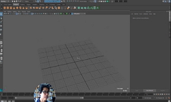
이에 따라 본 연구에서는 기 제작된 1960년대 청주도심 배치복원도를 토대로 하여 청주읍성 일대의 도심경관에 대하여 3D 디지털 복원을 하고자 하는 것이다. 특히 빠른 시간대에 간략하게 복원하기 위한‘파라메트릭 모델링(parametric modeling)’기법이 적용된다.
파라메트릭 모델링의 특징은 일반적인 상세모델링과 달리 모델을 개별적으로 상세히 제작하기 보다는 모델의 정해진 비율을 근거로 하여 형태를 유지한 채 모델을 대량으로 제작할 수 있으며, 또한 단순화된 객체들로 이루어져 프로그램 자체의 용량도 비교적 가볍게 운용되는 장점을 지닌다.
다국어 초록 (Multilingual Abstract)
In the 1960s, the downtown view of Cheongju was formed as a relatively settled residence outside the East-West and South-West Gates, with the former Cheongju Town Fortress at the center. The form of buildings built on blocks divided by the old street ...
In the 1960s, the downtown view of Cheongju was formed as a relatively settled residence outside the East-West and South-West Gates, with the former Cheongju Town Fortress at the center. The form of buildings built on blocks divided by the old street network still retains the low and thick view of the city.
However, due to economic rationality-oriented urban development, the city is losing the city scape of Cheongju Bay as high-rise buildings continue.
Accordingly, the introduction of a new management method is necessary to establish a management system for the vast elements that make up the city scape. Urban space is complicated by fixed elements such as buildings, structures, facilities and green areas that actually make up the city, and distribution factors such as transportation and users, and vertical and horizontal elements coexist. Therefore, in order to assess the urban landscape, there is a limit to the two-dimensional approach, so a three-dimensional approach should be taken. Visual elements are essential for recognizing space and collecting large amounts of information, consisting of three dimensions of urban space. Urban space is where we see the city with our own eyes, which is shown by the cityscape and the city image. As such, the visual composition of the urban landscape is to establish the management system of urban spaces through visual analysis.
By including the three dimensional elements of a city, proposing an urban landscape analysis model that reflects human visual perception characteristics, and looking at the relationship between spatial cognitive characteristics, the application feasibility can be presented as an urban landscape evaluation method.
In this study, the city scape of Cheongju City in the 1960s will be restored. In this case, a 'parametric modeling' technique is applied for easy restoration, and the characteristics of the parametric model can be mass-produced while retaining the form and allowing users to enter the desired values based on a defined proportion of the standardized model, rather than individually detailed models. In addition, the capacity of the program itself will be relatively light, with simplified objects.
목차 (Table of Contents)
- 1. 서 론 01
- 1.1 연구의 배경 및 목적 01
- 1.2 연구의 대상 및 범위 02
- 1.3 연구의 내용 및 방법 04
- 1. 서 론 01
- 1.1 연구의 배경 및 목적 01
- 1.2 연구의 대상 및 범위 02
- 1.3 연구의 내용 및 방법 04
- 2. 이론적 고찰 07
- 2.1 청주읍성 일대 도시공간구조의 변화 07
- 2.1.1 가로체계의 변화 07
- 2.1.2 가구 및 필지형태의 변화 08
- 2.1.3 건축경관의 변화 12
- 2.2 청주읍성 일대의 1960년대 복원 현황 15
- 2.2.1 지적의 복원 15
- 2.2.2 건축물 및 시설물 배치의 복원 16
- 2.2.3 복원 모델의 제작 17
- 2.3 파라메트릭 모델링의 구조 및 원리 20
- 2.3.1 건물의 객체기반 파라메트릭 모델링 20
- 2.3.2 파라메트릭 모델의 구조 23
- 2.3.3 파라메트릭 모델링 플랫폼 25
- 3. 건축물의 파라메트릭 모델링 27
- 3.1 파라메트릭 모델의 유형 분류 27
- 3.1.1 유형 분류의 기준 27
- 3.1.2 지붕형태에 의한 분류 28
- 3.1.3 지붕재료에 의한 분류 30
- 3.1.4 건물형태에 의한 분류 33
- 3.2 파라메트릭 모델의 매개변수 35
- 3.2.1 지붕의 매개변수 35
- 3.2.2 벽체의 매개변수 41
- 3.2.3 매개변수의 적용 42
- 3.3 파라메트릭 모델의 유형별 제작 47
- 3.3.1 맞배지붕 유형(A1~A6) 48
- 3.3.2 모임지붕 유형(B1~B6) 50
- 3.3.3 팔작지붕 유형(C1,C2) 52
- 3.3.4 평지붕 유형(D1,D2) 54
- 3.3.5 조합형 55
- 4. 청주읍성 일대 도심경관의 파라메트릭 모델링 57
- 4.1 파라메트릭 모델링의 프로세스 57
- 4.1.1 지형 및 지적 모델링 57
- 4.1.2 배치복원도의 검토 59
- 4.1.3 파라메트릭 모델의 작성 61
- 4.2 지붕형태별 3차원 디지털 복원 64
- 4.2.1 맞배지붕(A1~A6) 66
- 4.2.2 모임지붕 (B1~B6) 68
- 4.2.3 팔작지붕 (C1,C2) 70
- 4.2.4 평지붕 (D1,D2) 72
- 4.3 파라메트릭 모델의 시뮬레이션 74
- 4.3.1 시뮬레이션 작업 74
- 4.3.2 보행시선 시뮬레이션 76
- 4.3.3 조감뷰 시뮬레이션 78
- 5. 결론 85
- 참고문헌 87
- ABSTRACT 91
분석정보

이 자료와 함께 이용한 RISS 자료
나만을 위한 추천자료


