 국립중앙도서관 "우편 복사 서비스"로 연결 됩니다.


 ScienceON
 DBpia
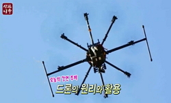
DBpia드론을 이용하여 고도 100 m에서 촬영한 고해상도 카메라 이미지를 분석하여 천해 해저지형 측량을 시도하였다. 쇄파대 내의 수심측량은 해안침식의 원인분석 등 관련 연구를 위해 가장 중요...
다국어 입력
あ
ぁ
か
が
さ
ざ
た
だ
な
は
ば
ぱ
ま
や
ゃ
ら
わ
ゎ
ん
い
ぃ
き
ぎ
し
じ
ち
ぢ
に
ひ
び
ぴ
み
り
う
ぅ
く
ぐ
す
ず
つ
づ
っ
ぬ
ふ
ぶ
ぷ
む
ゆ
ゅ
る
え
ぇ
け
げ
せ
ぜ
て
で
ね
へ
べ
ぺ
め
れ
お
ぉ
こ
ご
そ
ぞ
と
ど
の
ほ
ぼ
ぽ
も
よ
ょ
ろ
を
ア
ァ
カ
サ
ザ
タ
ダ
ナ
ハ
バ
パ
マ
ヤ
ャ
ラ
ワ
ヮ
ン
イ
ィ
キ
ギ
シ
ジ
チ
ヂ
ニ
ヒ
ビ
ピ
ミ
リ
ウ
ゥ
ク
グ
ス
ズ
ツ
ヅ
ッ
ヌ
フ
ブ
プ
ム
ユ
ュ
ル
エ
ェ
ケ
ゲ
セ
ゼ
テ
デ
ヘ
ベ
ペ
メ
レ
オ
ォ
コ
ゴ
ソ
ゾ
ト
ド
ノ
ホ
ボ
ポ
モ
ヨ
ョ
ロ
ヲ
―
http://chineseinput.net/에서 pinyin(병음)방식으로 중국어를 변환할 수 있습니다.
변환된 중국어를 복사하여 사용하시면 됩니다.
예시)
- 中文 을 입력하시려면 zhongwen을 입력하시고 space를누르시면됩니다.
- 北京 을 입력하시려면 beijing을 입력하시고 space를 누르시면 됩니다.
А
Б
В
Г
Д
Е
Ё
Ж
З
И
Й
К
Л
М
Н
О
П
Р
С
Т
У
Ф
Х
Ц
Ч
Ш
Щ
Ъ
Ы
Ь
Э
Ю
Я
а
б
в
г
д
е
ё
ж
з
и
й
к
л
м
н
о
п
р
с
т
у
ф
х
ц
ч
ш
щ
ъ
ы
ь
э
ю
я
′
″
℃
Å
¢
£
¥
¤
℉
‰
$
%
F
₩
㎕
㎖
㎗
ℓ
㎘
㏄
㎣
㎤
㎥
㎦
㎙
㎚
㎛
㎜
㎝
㎞
㎟
㎠
㎡
㎢
㏊
㎍
㎎
㎏
㏏
㎈
㎉
㏈
㎧
㎨
㎰
㎱
㎲
㎳
㎴
㎵
㎶
㎷
㎸
㎹
㎀
㎁
㎂
㎃
㎄
㎺
㎻
㎽
㎾
㎿
㎐
㎑
㎒
㎓
㎔
Ω
㏀
㏁
㎊
㎋
㎌
㏖
㏅
㎭
㎮
㎯
㏛
㎩
㎪
㎫
㎬
㏝
㏐
㏓
㏃
㏉
㏜
㏆

RISS 인기검색어
https://www.riss.kr/link?id=A103253476
- 저자
- 발행기관
- 학술지명
- 권호사항
-
발행연도
2017
-
작성언어
Korean
- 주제어
-
등재정보
KCI등재
-
자료형태
학술저널
- 발행기관 URL
-
수록면
162-168(7쪽)
-
KCI 피인용횟수
2
- 제공처
-
0
상세조회 -
0
다운로드
부가정보
국문 초록 (Abstract)
드론을 이용하여 고도 100 m에서 촬영한 고해상도 카메라 이미지를 분석하여 천해 해저지형 측량을 시도하였다. 쇄파대 내의 수심측량은 해안침식의 원인분석 등 관련 연구를 위해 가장 중요한 입력자료 중의 하나이다. 특히 이동한계수심 이내의 천해 수심자료는 연안 침퇴적 수치모델링을 위한 가장 중요한 입력자료 임에도 불구하고 정확한 해저지형측량 자료를 얻을 수 없었다. 그 이유는 선박을 이용한 상세 수심측량이 흘수 등을 고려할 때 수심 2 m 이내에서는 거의 불가능하며, 또한 쇄파와 연안류로 인해 선박 또는 사람이 직접 충분한 해상도로 측량하기에 매우 어렵기 때문이다. 따라서 소형 드론과 고해상도 카메라 이미지를 이용한 광학원격탐사는 매우 효과적인 천해수심측량 수단이 될 수 있다. 본 연구에서는 경북 월포해수욕장에서 드론으로 촬영한 고해상도 카메라 이미지의 적색, 녹색, 청색 그리고 회색 밴드 이미지를 다변수 선형회귀분석법으로 분석하여 천해 수심을 추정하고 실측한 수심자료와 비교하여 천해수심측량의 가능성과 정확도를 검토하였다. 드론에서 촬영한 이미지를 해저 지질, 바닷물의 색상, 부유사의 농도 등의 영향을 고려하지 않고 수심추정 알고리즘을 이용하여 분석한 결과 수심 5 m 이내에서 상관계수 0.99 이상, 절대오차 0.2 m 이하로 수심을 정확하게 추정할 수 있음을 확인하였다.
다국어 초록 (Multilingual Abstract)
Shallow-water bathymetry survey has been conducted using high definition color images obtained at the altitude of 100 m above sea level using a drone. Shallow-water bathymetry data are one of the most important input data for the research of beach ero...
Shallow-water bathymetry survey has been conducted using high definition color images obtained at the altitude of 100 m above sea level using a drone. Shallow-water bathymetry data are one of the most important input data for the research of beach erosion problems. Especially, accurate bathymetry data within closure depth are critically important, because most of the interesting phenomena occur in the surf zone. However, it is extremely difficult to obtain accurate bathymetry data due to wave-induced currents and breaking waves in this region. Therefore, optical remote sensing technique using a small drone is considered to be attractive alternative. This paper presents the potential utilization of image processing algorithms using multi-variable linear regression applied to red, green, blue and grey band images for estimating shallow water depth using a drone with HD camera. Optical remote sensing analysis conducted at Wolpo beach showed promising results. Estimated water depths within 5 m showed correlation coefficient of 0.99 and maximum error of 0.2 m compared with water depth surveyed through manual as well as ship-board echo-sounder measurements.
목차 (Table of Contents)
- 요지
- Abstract
- 1. 서론
- 2. 이론적 배경
- 3. 드론과 HD 카메라를 이용한 천해 수심 추정
- 요지
- Abstract
- 1. 서론
- 2. 이론적 배경
- 3. 드론과 HD 카메라를 이용한 천해 수심 추정
- 4. 결론
- References
참고문헌 (Reference)
1 이진학, "항공사진을 이용한 천해역에서의 수심 측량" 한국방재학회 16 (16): 351-358, 2016
2 Holman, R. A., "Surf zone characterization using a small quadcopter: technical issues and procedures" 55 (55): 2017
3 Hochberg, E. J., "Sea surface correction of high spatial resolution Ikonos images to improve bottom mapping in near-shore environments" 41 (41): 1724-1729, 2003
4 Irish, J.L., "Scanning laser mapping of the coastal zone : The SHOALS system" 54 (54): 123-129, 1999
5 Lyzenga, D. R., "Remote sensing of bottom reflectance and water attenuation parameters in shallow water using aircraft and Landsat data" 2 (2): 71-82, 1981
6 Lyzenga, D. R., "Passive remote sensing techniques for mapping water depth and bottom features" 17 (17): 379-383, 1978
7 Lyzenga, D. R., "Multispectral bathymetry using a simple physically based algorithm" 44 (44): 2251-2259, 2006
8 Srivastava, D. K., "Laser-assisted homogeneous charge ignition in a constant volume combustion chamber" 47 (47): 680-685, 2009
9 Setter, C., "LADS--From development to hydrographic operations" 94 : 1994
10 Zinke, P, "Experiences from the use of unmanned aerial vehicles (UAV) for river bathymetry modelling in norway" 48 : 351-360, 2013
11 Ahn, K., "Estimation of shallow water depth using drone and HD camera" 2016
12 Ehses, J.S., "Depth derivation using multispectral WorldView-2 satellite imagery" US Department of Commerce 24-, 2015
13 Jagalingam, P., "Bathymetry Mapping Using Landsat 8 Satellite Imagery" 116 : 560-566, 2015
14 Philpot, W. D., "Bathymetric mapping with passive multispectral imagery" 28 (28): 1569-1578, 1989
동일학술지(권/호) 다른 논문
-
KMA와 ECMWF 자료를 이용한 연안 유의파고의 분포 및 추세분석
- 한국해안해양공학회
- 고동휘(Dong Hui Ko)
- 2017
- KCI등재
-
해안선에 평행한 단일 잠제 후면 연안 흐름패턴 관측 수리실험
- 한국해안해양공학회
- 최준우(Junwoo Choi)
- 2017
- KCI등재
-
해저매설형 음향센서 시스템의 내구성 검증 방안에 대한 연구
- 한국해안해양공학회
- 신증호(Jeung Ho Shin)
- 2017
- KCI등재
-
- 한국해안해양공학회
- 심규태(Kyu-Tae Shim)
- 2017
- KCI등재
분석정보
인용정보 인용지수 설명보기
학술지 이력
| 연월일 | 이력구분 | 이력상세 | 등재구분 |
|---|---|---|---|
| 2027 | 평가예정 | 재인증평가 신청대상 (재인증) | |
| 2021-01-01 | 평가 | 등재학술지 유지 (재인증) |  |
| 2018-01-01 | 평가 | 등재학술지 유지 (등재유지) | |
| 2015-01-01 | 평가 | 등재학술지 유지 (등재유지) | |
| 2011-01-01 | 평가 | 등재학술지 유지 (등재유지) | |
| 2009-01-01 | 평가 | 등재학술지 유지 (등재유지) | |
| 2008-02-20 | 학술지명변경 | 한글명 : 한국해안,해양공학회지 -> 한국해안·해양공학회논문집 | |
| 2007-01-01 | 평가 | 등재학술지 유지 (등재유지) | |
| 2005-01-01 | 평가 | 등재학술지 유지 (등재유지) | |
| 2002-07-01 | 평가 | 등재학술지 선정 (등재후보2차) | |
| 2000-01-01 | 평가 | 등재후보학술지 선정 (신규평가) |  |
학술지 인용정보
| 기준연도 | WOS-KCI 통합IF(2년) | KCIF(2년) | KCIF(3년) |
|---|---|---|---|
| 2016 | 0.53 | 0.53 | 0.5 |
| KCIF(4년) | KCIF(5년) | 중심성지수(3년) | 즉시성지수 |
| 0.47 | 0.47 | 0.608 | 0.29 |


이 자료와 함께 이용한 RISS 자료
나만을 위한 추천자료


